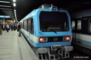
Prior to my 2009 trip to Cairo, someone mentioned to me that the city’s Metro was the most orderly institution in the entire city. In a country where schedules, tourist information, prices, and just about anything else you might want to know while traveling there is unpredictable at best, the Cairo Metro operates a frequent, reliable service that connects to a number of major tourist attractions. It is also among the cheapest Metro systems in the world, charging a flat, one way fare of 1 Egyptian Pound (equal to 0.11 USD at the time of this writing). However, reliable and easy to use as it may be, navigating Cairo’s transportation network is not nearly that simple.
Enter Transport for Cairo (TfC). This organization consisting of young Egyptians are looking to revolutionize the city’s chaotic transit system. While a basic Metro map does exist, no tourist in their right mind would try getting anywhere using the city’s bus network or its informal network of microbuses. After all, Cairenes are forced to navigate the system without any sort of maps or other official guidance from the agencies operating the system. TfC is working to develop maps and other data sources for the city’s commuters to use to figure out how to get around the sprawling metropolis. You can read about their work in this article from CityLab.
Oren’s Reading List is an occasional feature on The Travelogue in which I share articles that I’ve read that might also be of interest to the readers of this website.
