Happy Birthday to the New York City Subway!

no images were found

Today marks the 112th anniversary of the opening of the New York City Subway.  On this date in 1904, the first section of subway opened.  At that time, the line started at the now abandoned City Hall station, operated up the Lexington Avenue line to 42nd Street, jogged west on the tracks that are now used by the 42nd Street Shuttle, and then continued up the Broadway line to 145th Street.  Stopping at 28 stations on this original route (including four that are no longer in service), it was an instant hit with New Yorkers.
Today, the New York City has more stations than any other subway system in the world (469) serving 1.7 billion passengers annually.  It is one of the few in the world to operate 24 hours a day, 7 days a week and to have express tracks for much of its length.  The subway’s 113th year promises to be an exciting one as the Second Avenue Subway is (finally) due to open some time between now and next October 27 if all goes to plan.  We’ll see in a year from now if that actually happens, or if the SAS opening waits for year 114…


Oren’s Reading List: Riding Public Transit in Cairo After the Revolution

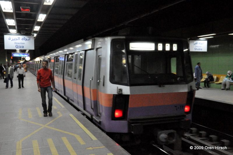
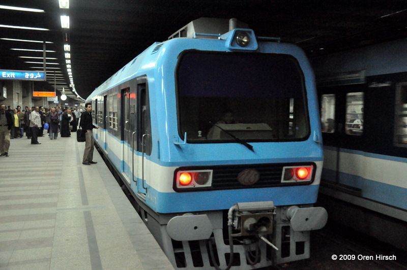
A few weeks ago, I posted an article about an attempt by Transport for Cairo (TfC) to map out all of Cairo’s transit services from its established Metro system to its informal microbus network.  I alluded to this a bit in that post, but riding the Metro in Cairo when I was there in 2009 was one of the easiest parts of my Egyptian tourist experience and probably was the most “western” activity I partook in while I was there.  There was no need to bargain about the fare or to pay baksheesh for “extras” while traveling.  Service was frequent and navigating the system was easy (though it only had two lines when I was there, so it isn’t that hard to find your train or keep track of how many stations until you reach your destination).  Apparently, that has changed a bit since the Egyptian Revolution, as the Metro was a way for the masses to get around during the overthrow of the government and the current government is looking to maintain its grip on power.  And while the Egyptian government continues to propose all sorts of new ideas for how to improve Cairo’s chaotic transportation network, simple steps could be taken that would deliver immediate improvements to a city with a population of 20 million where only about 11 percent of households have a car.  Interested in finding out more?  Read the article from CityLab here.

Oren’s Reading List is an occasional feature on The Travelogue in which I share articles that I’ve read that might also be of interest to the readers of this website.

Rail Photo of the Month: October 2016

SBB RBDe560

SBB RBDe560

Location: Martigny, Switzerland
Operator of Vehicle: SBB CFF FFS
Date of Photo: March 15, 2008

No matter what rolling stock you may encounter while traveling in Switzerland, chances are it will arrive right on time.  The stereotypes of Swiss railways running on time are not undeserved, though I do have to admit that I have been on a few delayed trains.  However, whether the train is pulled by the Class 460 locomotives that perhaps are most associated with SBB, or one of the trainsets such as the RBDe560 featured here, rest assured your fellow passengers are likely to be anxious if the train slips even just a few minutes behind schedule.

These RBDe560 trainsets can be found on S-Bahn services in the Basel area as well as on suburban and regional services elsewhere in the country.  They were first delivered starting in 1984 and while some of the cars have been retired, others were recently rebuilt and will remain in service indefinitely.

For more photos of SBB’s trains, please click here.

Bus Photo of the Month: October 2016

NovaBus RTS T80 206 0309

NovaBus RTS T80 206 0309

Location: Massachusetts Avenue at Brattle Street, Boston, MA
Operator of Vehicle: Massachusetts Bay Area Transit Authority (MBTA)
Date of Photo: May 2, 2011

Since 1977, the “RTS” has been plying the streets for transit agencies across the United States.  Perhaps, these buses are associated most with New York City, where they made up much of the bus fleet in the 1990s.  However, they had a presence in lots of other cities, too, such as Washington, Philadelphia, Chicago, and Boston.  It is in the last of these cities that I took this photo back in 2011.  Even five years ago, the RTS’s dominance in the Boston bus fleet was already considered to be a time that had passed.  However, the RTS is not completely gone from the streets of Boston.  Although the RTSs are being retired gradually, the last ones are expected to remain in service until sometime in 2018.

For more photos of MBTA’s RTS buses, please click here.

Oren’s Reading List: Developing a Transit Map for Cairo

Prior to my 2009 trip to Cairo, someone mentioned to me that the city’s Metro was the most orderly institution in the entire city.  In a country where schedules, tourist information, prices, and just about anything else you might want to know while traveling there is unpredictable at best, the Cairo Metro operates a frequent, reliable service that connects to a number of major tourist attractions.  It is also among the cheapest Metro systems in the world, charging a flat, one way fare of 1 Egyptian Pound (equal to 0.11 USD at the time of this writing).  However, reliable and easy to use as it may be, navigating Cairo’s transportation network is not nearly that simple.

Enter Transport for Cairo (TfC).  This organization consisting of young Egyptians are looking to revolutionize the city’s chaotic transit system.  While a basic Metro map does exist, no tourist in their right mind would try getting anywhere using the city’s bus network or its informal network of microbuses.  After all, Cairenes are forced to navigate the system without any sort of maps or other official guidance from the agencies operating the system.  TfC is working to develop maps and other data sources for the city’s commuters to use to figure out how to get around the sprawling metropolis.  You can read about their work in this article from CityLab.

Oren’s Reading List is an occasional feature on The Travelogue in which I share articles that I’ve read that might also be of interest to the readers of this website.


Jerusalem Meets Paris

Alstom Citadis 302 001 on Derech Yafo (Jaffa Road) at Shlomtzion HaMalka, June 2, 2016

The Jerusalem Light Festival has been taking place each summer since 2011.  Each night for just over a week, exhilarating light displays are set up throughout the Old City.  This year, the festival extended up Jaffa Road, the historic main thoroughfare through the newer, western part of the city that now also serves as the right of way for the Jerusalem Light Rail route through the city center.  One of the installations on Jaffa Road was a miniature Eiffel Tower.  Since the light rail operates using French built Alstom Citadis 302 vehicles, it seemed only natural to try getting a photo of the Eiffel Tower replica and a light rail train in the same shot.  This is where my title for the photo, and this post, came from.

Jaffa Road has become a great pedestrian space since road was closed to vehicular traffic and the light rail was constructed on the thoroughfare, so it was difficult to get a shot without pedestrians blocking either the train, the Eiffel Tower model, or both.  Furthermore, the fact it was night meant that I needed to be using settings that ran the risk of a blurry photo if I wasn’t steady while I operated the camera and as the train went by.  (This photo was taken with an ISO speed of 800, a shutter speed of 1/50 second, and an f-stop of 3.5.)  Despite the fact it was about midnight when I was there, trains were running fairly frequently, and I had several opportunities to try getting the photo I desired.  This is the best of my attempts, and I think it is quite a good one.

Incidentally, this isn’t my only photo of the light rail with a connection to this year’s light festival.  Several trains had a band of lights installed along their rooflines and I got a few photos of those trains, too.  One of those photos can be seen below.

Alstom Citadis 302 037 on HaTsanhanim between Damascus Gate and Kikar Tzahal, June 2, 2016

For more photos of the Jerusalem Light Rail, please click here.  Oren’s Transit Page also has photos from some of the other cities around the world that operate the Alstom Citadis 302, including Paris, Madrid, and Rotterdam.


WMATA’s Oldest Railcar Still Rolling Along

WMATA Rohr 1000, the lowest numbered car in the Metrorail fleet, at Silver Spring Station, September 14, 2016

WMATA Rohr 1000, the lowest numbered car in the Metrorail fleet, at Silver Spring Station, September 14, 2016

Yesterday, I happened to catch a ride on board WMATA Rohr car number 1001.  Although it isn’t the lowest numbered railcar in the fleet (that distinction goes to its mate, car 1000), it was the first to be delivered to WMATA and as far as I’m concerned, it is therefore the oldest car in the WMATA fleet.

Unfortunately, since 2009, the 1000 Series cars no longer operate at the ends of trains, so getting photos of the front end in the “usual style” is no longer possible without yard access.  However, I did have the opportunity to ride both 1000 and 1001 prior to this policy change and also have photos of them at the front of trains.

As I wrote back when the first Rohr car was shipped off to Baltimore for scrapping, to my knowledge, there are no plans to preserve any of the Rohr cars.  I doubt anyone on board the train with me yesterday knew about the significance of the train they were on, but it remains my hope that someone has the good sense to preserve the 1000-1001 pair as it makes up a significant piece of Washington, DC’s transit history.

London U-Bahn Map

Did you ever expect to see the London Underground or “The Tube” referred to as the U-Bahn?  U-Bahn is the German term for subway and is used in just about each German city that has an underground rail network.  Yesterday, I shared a 1973 London Underground map with you.  Today, I’m sharing another London Underground map, except this one is from 1975 and printed in German for the benefit of German speaking tourists.  I don’t speak or read German aside from knowing a few select words, but my guess is that the texts on this map are just straight translations from the standard English language that would be used to German.  It is certainly an interesting addition to my collection as I don’t think I’ve ever seen a London Underground map in a language other than English.

Here are the scans of the map.  You can click on each image to make it larger and see it at full size.

london-underground-1973-german-page-1-t london-underground-1973-german-page-2-t london-underground-1973-german-page-3-t

Taking a Look at the 1973 London Underground Map

As I mentioned last week, I recently inherited a number of old maps from a variety of places around the world and they are now a part of my collection of maps and other transit memorabilia.  I plan to share some of the more interesting additions from this inheritance here on The Travelogue in the coming weeks.

This is a 1973 London Underground Map.  While the London Underground map design has remained fairly constant since Harry Beck’s initial diagram in 1931, there are some notable things on this map that are not the case today.  These include:

  • The Piccadilly Line to Heathrow Airport is under construction
  • The Jubilee Line is not yet open and Bakerloo Line trains operate the branch to Stanmore
  • The Hammersmith & City Line is still depicted as part of the Metropolitan Line
  • The East London Line has a partial identity of its own, but it is depicted in Metropolitan Line purple as opposed to the orange color it would have later on
  • The Docklands Light Railway is not on the map and will not exist for another 14 years

What other differences do you see?  You can click on the images to make them larger.  I apologize for any issues with the quality as the maps were scanned, converted to JPEG, and then compressed to a size manageable for sharing here on Oren’s Transit Page.

london-underground-1973-map-english-1-t

london-underground-1973-map-english-2-t london-underground-1973-map-english-3-t


Oren’s Reading List: London Publishes Geographically Accurate Tube Map

Have you ever thought to yourself while riding a train that even though the subway map seems to suggest the stations are evenly spaced, they aren’t actually so in reality?  You’re right to notice this.  Subway maps have been drawn without using a scale for a long time.  The first example of such a map is Harry Beck’s London Underground Map form 1931.  Many of the principles that Beck used in designing this map are still not only used in London but in many other cities around the world.  However, people sometimes draw scale versions of various maps to show the differences between the official map and what a scaled map would look like.

Officially, Transport for London (TfL) has not put out a geographically accurate map since Harry Beck’s diagram became the official one in 1933.  However, following a freedom of information request in 2014. TfL released such a map for the first time in many years.  Read about the FOI process and see the map for yourself in this story from The Independent.

In upcoming posts, I plan to share some old maps that I recently inherited and added to my collection, the first of which will feature maps of the Underground.  Stay tuned…

Oren’s Reading List is an occasional feature on The Travelogue in which I share articles that I’ve read that might also be of interest to the readers of this website.