Oren’s Reading List: Transportation Gifts

The holiday shopping season is well underway.  If you’re reading this, odds are you wouldn’t mind receiving or are looking for ideas for transportation related gifts.  The Chicago Tribune recently compiled a list of CTA and METRA themed holiday gifts and links to where you can find those items for purchase.  Many other transit agencies, including New York City Transit and WMATA, also have online gift stores that you can peruse.  While a friend of mine has received three copies of Transit Maps (and doesn’t seem bothered by the fact based on my conversation about it with him), I hope some of these links are useful if you’re looking to make sure the person you are giving  Happy shopping!

Oren’s Reading List is an occasional feature on The Travelogue in which I share articles that I’ve read that might also be of interest to the readers of this website.

Oren’s Reading List: Riding Public Transit in Cairo After the Revolution

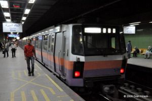
A few weeks ago, I posted an article about an attempt by Transport for Cairo (TfC) to map out all of Cairo’s transit services from its established Metro system to its informal microbus network.  I alluded to this a bit in that post, but riding the Metro in Cairo when I was there in 2009 was one of the easiest parts of my Egyptian tourist experience and probably was the most “western” activity I partook in while I was there.  There was no need to bargain about the fare or to pay baksheesh for “extras” while traveling.  Service was frequent and navigating the system was easy (though it only had two lines when I was there, so it isn’t that hard to find your train or keep track of how many stations until you reach your destination).  Apparently, that has changed a bit since the Egyptian Revolution, as the Metro was a way for the masses to get around during the overthrow of the government and the current government is looking to maintain its grip on power.  And while the Egyptian government continues to propose all sorts of new ideas for how to improve Cairo’s chaotic transportation network, simple steps could be taken that would deliver immediate improvements to a city with a population of 20 million where only about 11 percent of households have a car.  Interested in finding out more?  Read the article from CityLab here.

Oren’s Reading List is an occasional feature on The Travelogue in which I share articles that I’ve read that might also be of interest to the readers of this website.
Oren’s Reading List: Developing a Transit Map for Cairo

Prior to my 2009 trip to Cairo, someone mentioned to me that the city’s Metro was the most orderly institution in the entire city.  In a country where schedules, tourist information, prices, and just about anything else you might want to know while traveling there is unpredictable at best, the Cairo Metro operates a frequent, reliable service that connects to a number of major tourist attractions.  It is also among the cheapest Metro systems in the world, charging a flat, one way fare of 1 Egyptian Pound (equal to 0.11 USD at the time of this writing).  However, reliable and easy to use as it may be, navigating Cairo’s transportation network is not nearly that simple.

Enter Transport for Cairo (TfC).  This organization consisting of young Egyptians are looking to revolutionize the city’s chaotic transit system.  While a basic Metro map does exist, no tourist in their right mind would try getting anywhere using the city’s bus network or its informal network of microbuses.  After all, Cairenes are forced to navigate the system without any sort of maps or other official guidance from the agencies operating the system.  TfC is working to develop maps and other data sources for the city’s commuters to use to figure out how to get around the sprawling metropolis.  You can read about their work in this article from CityLab.

Oren’s Reading List is an occasional feature on The Travelogue in which I share articles that I’ve read that might also be of interest to the readers of this website.


Oren’s Reading List: London Publishes Geographically Accurate Tube Map

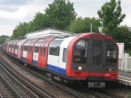
Have you ever thought to yourself while riding a train that even though the subway map seems to suggest the stations are evenly spaced, they aren’t actually so in reality?  You’re right to notice this.  Subway maps have been drawn without using a scale for a long time.  The first example of such a map is Harry Beck’s London Underground Map form 1931.  Many of the principles that Beck used in designing this map are still not only used in London but in many other cities around the world.  However, people sometimes draw scale versions of various maps to show the differences between the official map and what a scaled map would look like.

Officially, Transport for London (TfL) has not put out a geographically accurate map since Harry Beck’s diagram became the official one in 1933.  However, following a freedom of information request in 2014. TfL released such a map for the first time in many years.  Read about the FOI process and see the map for yourself in this story from The Independent.

In upcoming posts, I plan to share some old maps that I recently inherited and added to my collection, the first of which will feature maps of the Underground.  Stay tuned…

Oren’s Reading List is an occasional feature on The Travelogue in which I share articles that I’ve read that might also be of interest to the readers of this website.

Oren’s Reading List: NYC Subway Record

34th Street-Hudson Yards Station, December 27, 2015

I enjoy riding trains, perhaps more than most.  That said, I don’t think Matthew Ahn needs to worry about my breaking his record for fastest trip through the entire New York City Subway.  He had the Guinness World Record for the feat, but then the new 34th Street-Hudson Yards station opened on the 7 last year.  Not only did Ahn set out to make sure he would still have the record for the expanded system, he beat his original record by about 21 minutes!  Read about his 21 hour 28 minute 14 second odyssey through all 469 New York City subway stations in this article from the New York Daily News.

While I don’t have any aspirations to challenge this record, I have been to every station on the subways in Washington, DC, Toronto, Rome, Haifa, as well as the entire Jerusalem Light Rail, in a single day (and some of those were on a single fare, too).  What about you?

Oren’s Reading List is an occasional feature on The Travelogue in which I share articles that I’ve read that might also be of interest to the readers of this website.

Oren’s Reading List: Subway Train or Temperature Converter?

It’s been hot and sticky in the northeast US in the past few days.  Need to convert the temperature in Fahrenheit to Celsius?  (After all, those smaller numbers on the Celsius scale ought to be cooler, or is that just wishful thinking?)  Just take a look at the NYC Subway map!

I’m not kidding either!  A friend recently shared this article with me on Facebook, explaining how the 6 train stops on the East Side of Manhattan can also serve as a nifty Farenheit to Celsius conversion table.  Don’t believe me?  Check it out below!

Subway map or temperature conversion table? Take your pick! Image from https://twitter.com/gabor.

Oren’s Reading List is an occasional feature on The Travelogue in which I share articles that I’ve read that might also be of interest to the readers of this website.

Oren’s Reading List: The 11 Most Beautiful Train Stations Across America

Even if the golden age of train travel in the US is more of a memory than anything else today, its remnants are still visible to anyone who still travels by rail.  Thrillist.com has put together a list of the 11 most beautiful train stations in the United States.  I’ve been to 7 of the 11.  How many have you been to?  Which is your favorite?  Was something left off the list that you think should have been included?  Check out the list here and then answer any or all of these questions in the comments below!

Oren’s Reading List: Stories Behind CTA ‘L’ Lines’ Strange Curves, Dips and Twists

The L in Chicago is one of my favorite transit systems to ride in the US.  The system is mostly elevated and at times it feels like you can just reach in to the apartment buildings you pass by because they are that close to the right of way.  But another highlight of the system are the many sharp twists and turns the trains take as they snake their way through the city.  How did some of these, such as the two 90 degree curves on either side of the Red Line’s Sheridan station (pictured here), come to be?  Chicago radio station WBEZ looked in to this question and offers the answer in this article on their website, accompanied by an audio report as well.

Oren’s Reading List is an occasional feature on The Travelogue in which I share articles that I’ve read that might also be of interest to the readers of this website.

Oren’s Reading List: Paris’s New (Unofficial) Metro Map

In the article I posted yesterday, Paris’s iconic metro map is ranked as being the second most complex in the world.  I’ll admit, it certainly seems a bit overwhelming to me each time I look at it. Recently, a design studio made an attempt to improve the map by using lines 2 and 6 to make a perfect circle around central Paris, modifying angles to be at 30 and 60 degrees instead of at 45 degrees, and then filling in the rest of the lines based on these principles.  The map even includes certain attractions such as the Eiffel Tower, indicating where one should get off to reach these destinations, and can easily accommodate the future Line 15, which will be another circular Metro line around the city.  Do you prefer this design over the traditional Paris Metro map?  Read about the new (albeit unofficial) map here and decide which you prefer for yourself!

Oren’s Reading List is an occasional feature on The Travelogue in which I share articles that I’ve read that might also be of interest to the readers of this website.

Oren’s Reading List: The World’s 15 Most Complex Subway Maps

Ever look at a subway map and think to yourself “how on earth am I ever going to figure out where I’m going by using this thing?”  Recently, a group of theoretical physicists and mathematicians attempted to figure out which maps “exceed our cognitive limits.”  If you think the New York City subway map is overwhelming, the research team would agree with you.  You can read a summary of the study’s findings and see the list of the 15 most complex maps at CityLab, or you can read the entire paper (it is only 8 pages) at ScienceAdvances.

Oren’s Reading List is an occasional feature on The Travelogue in which I share articles that I’ve read that might also be of interest to the readers of this website.